
Hey there,
it’s been a while since my last post. Since then - with the help of this awesome community - I have added multiple new features and fixed a lot of bugs.
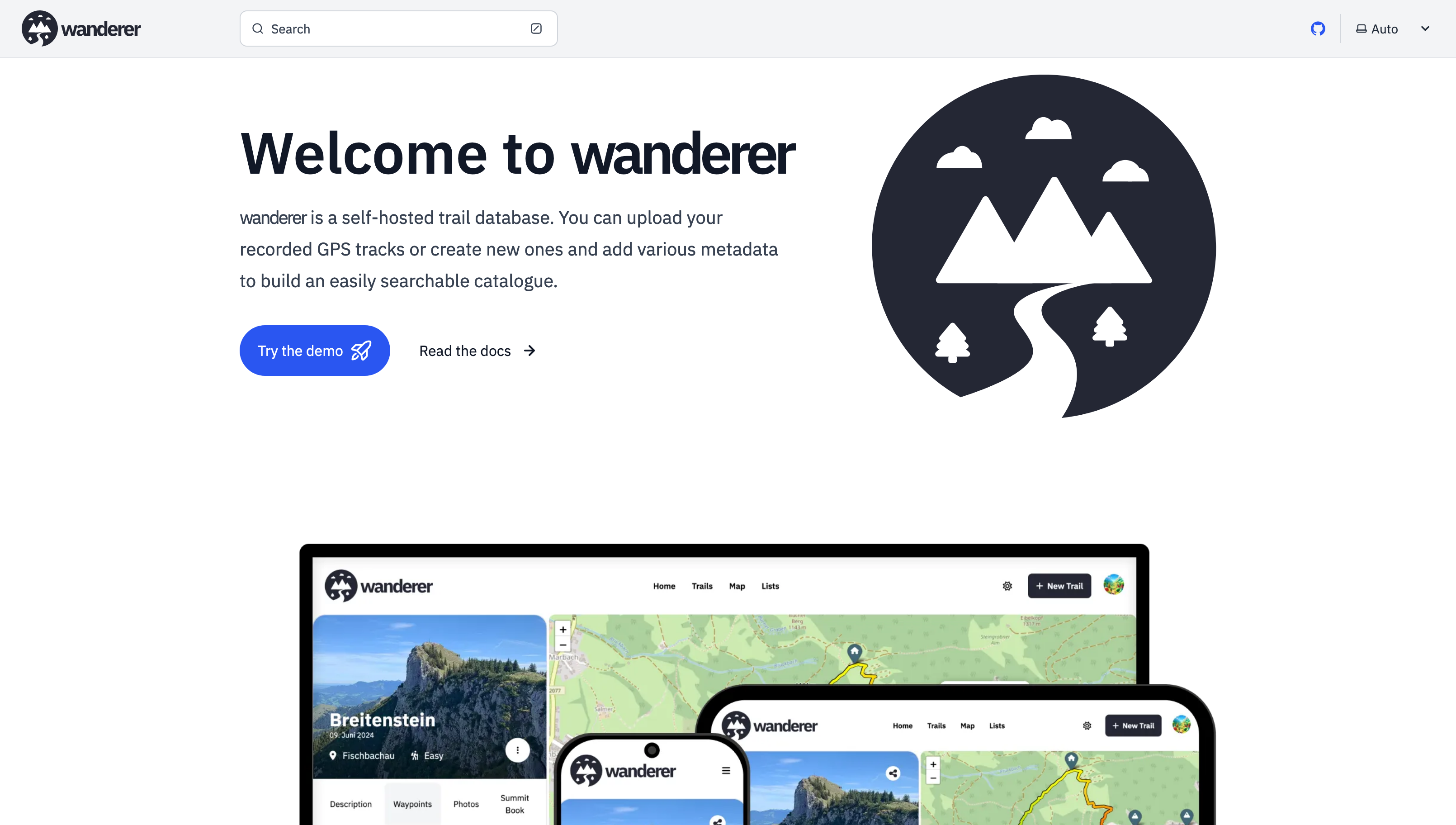
Most importantly there is now a working demo alongside a shiny new landing page.
And here are some more fun features I added since then:
- Trail drawing: in addition to uploading you GPX, TCX or KML files, you can now also simply draw a trail by defining multiple waypoints. The route between them will be calculated automatically.
- Sharing trails: simple and straightforward - you can share your trails with other users and let them view or edit.
- Printing trails: there is now a dedicated print view. Plan your adventure digitally and then take it with you on paper.
- wanderer is now available in 8 different languages (thanks to translators from the community). If you would like to contribute a translation you can do so here.
- You can now bulk upload multiple trails at once simply by putting them in a dedicated auto-upload folder
And much more. I’d be happy if you give it a try in case you haven’t yet.
GitHub repo: https://github.com/Flomp/wanderer
If you guys like hiking and stuff, there’s this cool open source app called trail sense on f-droid and it’s just so much feature packed…
I don’t hike, so I only use it for it’s pedometer capabilities and a hypothetical situation where “I might get really lost” but the amount of features it has for hiking and survival is crazy and so I think deserves to be more known.
I’ll install this on my Lab it looks cool!
Also, is there any mobile app that can trace and upload trails I do in the day ?
Cool! I always recommend OsmAnd.
Looks like what I wanted! However, it doesn’t seem to let me export to a supported format for Wanderer (only kmz?), could you confirm @get_flomped@lemmy.world ?
I don’t know the app. But on the linked page it says it supports GPX and KML. Both of which wanderer supports.
Open Tracks allows exporting in either KMZ (default), KML or GPX format. Go to Settings, tap on “Import and Export” and there look, towards the end, for the entry “Export/sharing file format”.
Awesome, thanks for the tip! I’ll try the app on my next trail trip
On iOS there is GPX Tracker which simply records a GPX track and can overlay openstreetmap data while doing so.
Hi, this looks amazing, I’ll try it ! How is Pocketbase? What are your thoughts working with it?
Also, have you thought about federating trails? It would be amazing we could build a decentralized alternative to the big corps.
I really love working with PocketBase. It gives you such a headstart, but also is highly customizable. It’s really the best of both worlds.
Looks pretty cool. I’ll have to spin up a VM to give it a try.
Or use the demo ;)
Is there any support for heart rate data inclusion on recorded trails? Maybe I’m really looking for a different app to keep track of that sort of thing. I haven’t yet started monitoring heart rate on my bike rides but I’m considering options for tracking now.
I host wanderer and really enjoy it for what it is. I’m only supporting my wife and I but am considering opening it up to my friend group.
Super cool!!
deleted by creator
Thanks, I will definitely give this a try.


