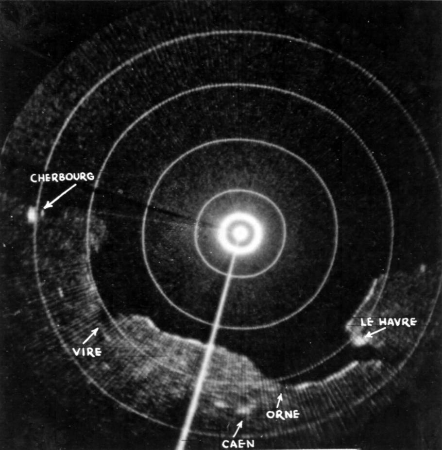
SSTF to HistoryPorn@lemmy.worldEnglish • edit-21 year agoAirborne radar scope image of the Normandy coastline taken just before the invasion.lemmy.worldimagemessage-square4fedilinkarrow-up197arrow-down12file-text
arrow-up195arrow-down1imageAirborne radar scope image of the Normandy coastline taken just before the invasion.lemmy.worldSSTF to HistoryPorn@lemmy.worldEnglish • edit-21 year agomessage-square4fedilinkfile-text
minus-squareackzsellinkfedilink2•1 year agoThis is most definitely the Netherlands. More specific the “Afsluitdijk” (referred to as Zuider Zee Dam).
minus-squareSSTFOPlinkfedilinkEnglish5•1 year agoI had another radar image up about 30 seconds accidentally before changing it to this one. If you somehow saw that old image right as the post went up my mistake, but the one that’s up is Normandy.
minus-squareMaestrolinkfedilink3•1 year agoYes, the linked article does have images of Normany, but this is clearly Holland
minus-square@crapwittyname@lemm.eelinkfedilinkEnglish2•1 year agoIt’s most definitely the French coastline, and most definitely not the dam. Go look at a map.


This is most definitely the Netherlands. More specific the “Afsluitdijk” (referred to as Zuider Zee Dam).
I had another radar image up about 30 seconds accidentally before changing it to this one. If you somehow saw that old image right as the post went up my mistake, but the one that’s up is Normandy.
Yes, the linked article does have images of Normany, but this is clearly Holland
It’s most definitely the French coastline, and most definitely not the dam. Go look at a map.